Find a paved waterfront stroll, a walk under the trees or a boardwalk through the wetland.
3 trail guides. Check the operator for current closures before heading out.
Glenwood Cemetery chapel and grounds, Picton · photographed August 3, 2010 Glenwood Cemetery - panoramio · deltawhiskybravo · CC BY-SA 3.0 · Resized proportionally to 1280 × 820 and encoded as WebP (quality 78); metadata removed; no content retouching. Responsive display may crop the image.
Glenwood Cemetery, Picton
Glenwood Cemetery walking paths
DistanceMaple Trail: about 1.5 km; other routes vary
SurfaceGravel paths and roadways
SettingWoodland and cemetery grounds
Walk the wooded, rolling cemetery grounds from Ferguson Street, choosing a route using Glenwood’s trail map.
What to expect
Respect services, graves and monuments.
Leashed dogs are welcome; pick up after them.
Paths are not cleared of snow or ice.
Access: Gravel and variable terrain; choose a route with the operator. A seasonal washroom is behind the chapel.
Trail details & getting there
Maple Trail has changes in elevation; Marsh Creek Trail is described as having no hills.
An eastern footpath connects with Delhi Park.
Where to start
Main entrance at 47 Ferguson Street.
Outdoor visits and designated parking are free.
Choose the entrance for the section you want to explore.
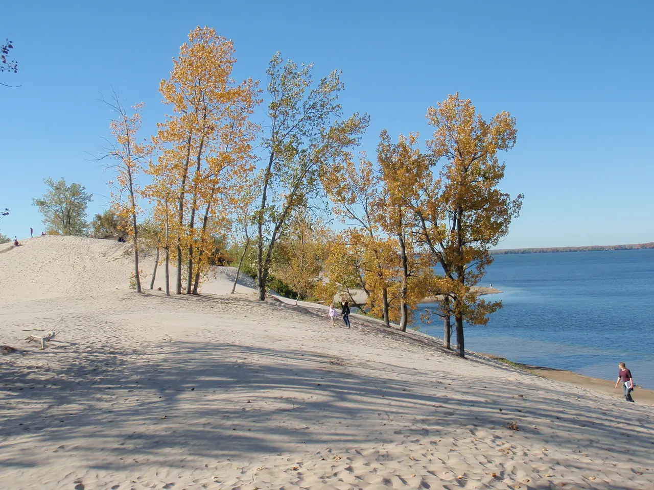
Sandbanks dune habitat · photographed October 10, 2010; historical landscape view Sandbanks Park, Prince Edward County 2010 48 · XeresNelro · CC BY-SA 4.0 · Resized proportionally to 1280 × 960 and encoded as WebP (quality 78); metadata removed; no content retouching. Responsive display may crop the image.
Sandbanks Provincial Park, Prince Edward County
Sandbanks Dunes Trail
Distance2.5 km loop
SurfaceSandy dune terrain; barrier-free loop at the start
SettingDunes and wetlands
A loop through sand dunes and beside shallow wetland habitats.
What to expect
Stay on marked paths to protect fragile habitat.
Poison ivy is common in the area.
Access: The barrier-free description applies to the initial 1 km loop, not the full dunes route. Confirm current conditions.
Trail details & getting there
Operator rating: easy to moderate.
A separate 1 km loop at the start is described as barrier-free.
Where to start
Dunes trailhead shown on the Ontario Parks map.
Check current day-use permit requirements and seasonal access with Ontario Parks.
Choose the entrance for the section you want to explore.
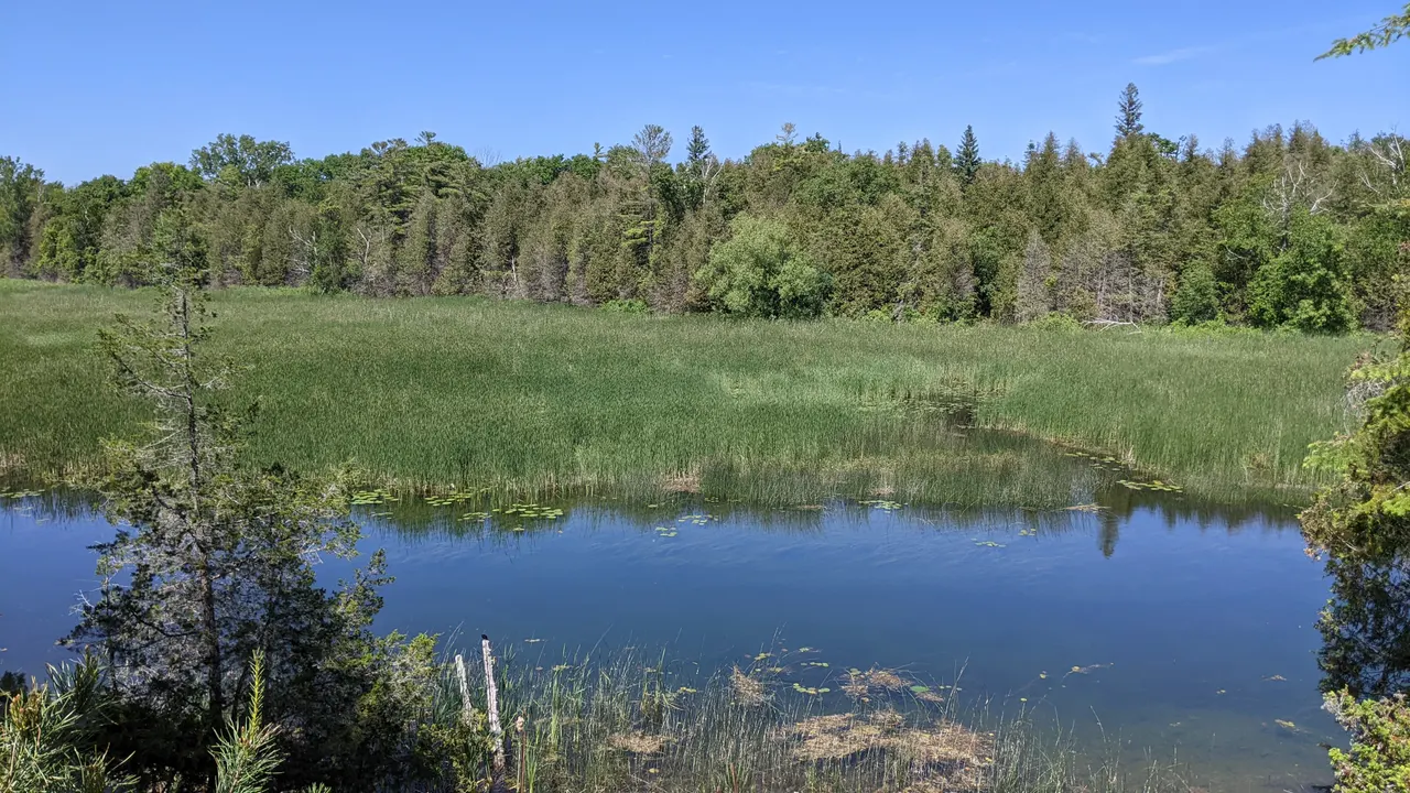
Outlet River beside the Cedar Sands walking area · photographed June 20, 2022; river view rather than a trail-surface survey Outlet River, Sandbanks Provincial Park, Ontario, Canada · Maxime Laterreur · CC BY 4.0 · Resized proportionally to 1280 × 720 and encoded as WebP (quality 78); metadata removed; no content retouching. Responsive display may crop the image.
Sandbanks Provincial Park, Prince Edward County
Cedar Sands Nature Trail
Distance2 km loop
SurfaceNatural trail; confirm current surface conditions
SettingRiver and marsh
An interpretive loop beside the Outlet River with marsh viewpoints.
What to expect
River-edge and wetland scenery.
Access: The operator does not describe this route as barrier-free; ask about grade and surface before setting out.
Trail details & getting there
Twelve interpretive stops and two marsh lookouts.
A trail guide is available at the trailhead or Friends gift shop.
Where to start
Cedar Sands trailhead shown on the Ontario Parks map.
Check current day-use permit requirements and seasonal access with Ontario Parks.
Choose the entrance for the section you want to explore.